|
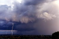
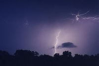
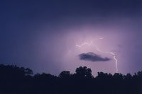
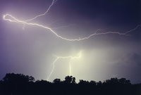
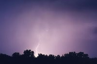
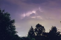
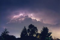
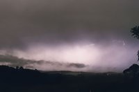
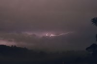
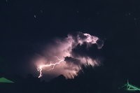
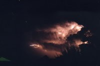
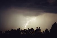
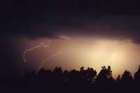
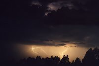
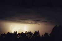
The storm chasing season in Sydney for 1998/99 was quite poor with very few opportunities for lightning photography. On Friday 13th November three thunderstorms developed in the same location in the SW suburbs and all tracked ESE. A feature of all these storms was hail (some up to golf ball size) and very heavy rain. These two shots were captured around sunset as the third storm spread eastwards, and soon dissipated. 50mm lens, F22 15 seconds & F22 40 seconds on auto exposure. [more information about this storm]
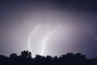
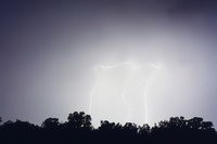
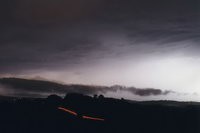
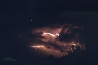
After an all day storm chase from Sydney to Moree (over 700km), the evening was topped off nicely with some lightning near Moree. Rain resulted in the lightning appearing a little washed out, but it was still nice to capture it. 50mm lens, all F4 30-90 seconds.
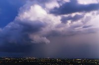
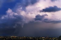
This was the evening of the Sydney Supercell on 14th April 1999 which caused over $1.5 billion in damage when hail over 10cm diameter smashed through the eastern suburbs. I was about 40 kilometres west of the storm, watching via radar on my PC and out the front of my house. I took a few pics but it was a difficult setup. Not all that much lightning was visible due to other cloud in the way, and a lot of city light made it too glary. In the excitment of the event, I forgot to note the camera settings for these.
A great shelf cloud formation during the late afternoon preceded some lightning on this Winter evening at McLeans Ridges, NSW. F2.8 for 90 seconds.
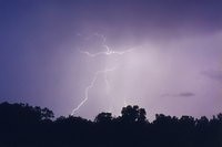
Severe storms spread in from the Northern Tablelands but weakened near the coast. This was taken from McLeans Ridges, NSW about 8.30pm. F4 for 40 seconds.
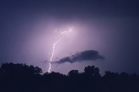
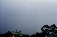
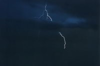
A single bolt drops down at the front of my house during a weak thunderstorm at Wollongbar, NSW. F4 for 120 seconds.
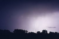
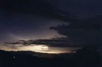
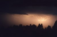
Weak storm activity persisted around the Lismore area during the afternoon, while SE Queensland had some large storms. During the evening, a cell passed along the coast about 30 kilometres to my east.
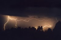
A powerful storm ripped in from the SW along the Richmond River area in NE NSW. This gave hail and very strong wind gusts. I took this photo from Meerschaum south of Alstonville, but unfortuantely had the apatuer set too high. [more information about this storm]
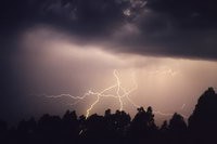
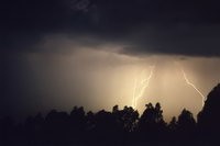
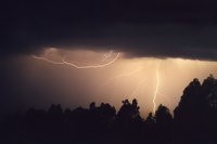
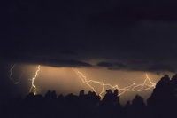
After virtually no lightning opportunities for nine months, storm activity lingered into the evening on the NSW North Coast on 26th September 2000. At first activity was a bit too far away to get a decent shot, but fortunately a storm cell developed just east of my house at 11.30pm. The sequence above were all taken with a 50mm lens, F4 and exposure times of 1 to 5 minutes. [more information about this storm]
|